Mangrove restoration mitigates climate change through the reduction of greenhouse gas emissions
Place: El Playon, Mexico / Author: Jorge Herrera Silveira Long-term records are needed to achieve a better understanding of basic reef processes, tolerances, and trends.
Place: Tankah-Cuevitas, Mexico / Author: Mario Chow
Short-term monitoring projects
Under the SWAMP project, CORESCAM members were able to conduct pioneering research on regional mangrove responses in the 2017 mega-hurricane season.
The Sustainable Wetlands Adaptation and Mitigation Program (SWAMP) evolved from a multi-stakeholder exercise (CIFOR, USAID and USFS) called the Tropical Wetlands Initiative for Climate Adaptation and Mitigation (TWINCAM) which aimed to respond to a variety of challenges ranging from sustainable management of local to global needs.
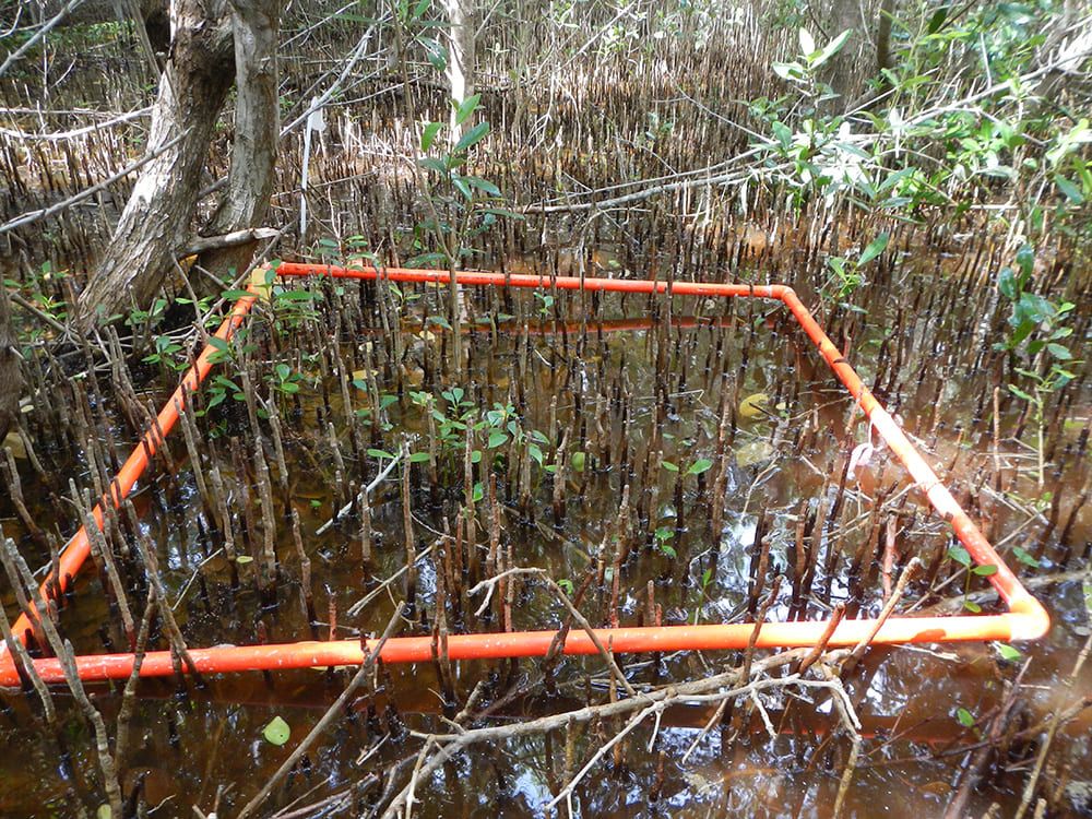
Placement of 1 x 1 subplot for the measurement of mangrove seedlings (source: CIFOR/CINVESTAV-IPN/UNAM-Sisal/PMC)
Long-term monitoring projects
The study that CORESCAM is carrying out requires working with data at regional, continental, and planetary scale, collected over 20 or 30 years (long-term data). These data allow analysis of baselines and trends. Regional collaboration and multi-year projects are essential for science to provide robust responses to society and decision-makers.
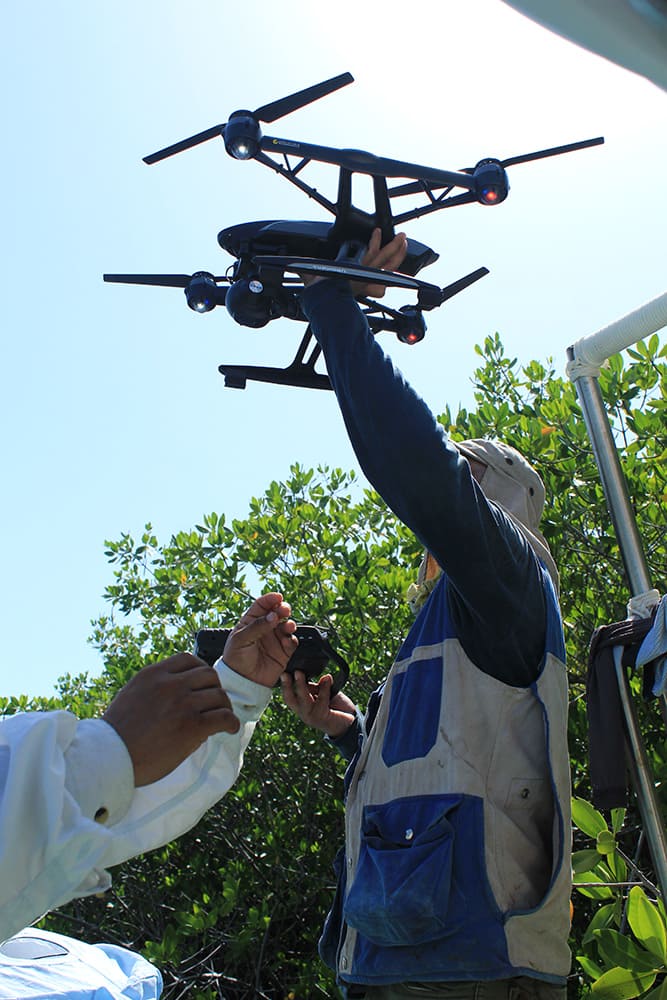
A drone flight can cover between 1 – 5 hectares in a single mission (depending on the specifications of each drone). The information obtained is essential as part of the continuous monitoring of restored mangrove vegetation (source: CIFOR/CINVESTAV-IPN/UNAM-Sisal/PMC)
In the region we are already working on a long-term coastal and marine ecosystem monitoring initiative known as CARICOMP (Caribbean Coastal Marine Productivity) that has been collecting data from reefs and mangroves periodically from the 90s to 2007, out of which there are still places that produce data.
We also have the AGRRA reef monitoring initiative formed in 1998 to study, monitor and protect the reef ecosystems of the Caribbean.
On the other hand, collaboration with some of our regional partners will provide us with long-term data for specific sites to be analyzed in this project.